
Ontario’s Oldest Snow Tour Is Alive & Kicking…

Click photo to view full tour article
Related: Ontario’s Self-Guided Snow Tours
Snowmobile RAP Tour anyone? Algonquin Park has a worldwide reputation and mystique beyond Ontario snowmobiling. It’s an alluring magnet that continues to attract outdoors adventurers, including snowmobilers who make a pilgrimage called the RAP (‘Round Algonquin Park) Tour on Ontario snowmobile trails. This is the grand daddy of Ontario snowmobile tours: the first “signature” loop, officially launched more than two decades ago.
The RAP Tour led the way: The Ontario Federation of Snowmobile Clubs (OFSC) has since established many signature snow tours on Ontario snowmobile trails. Many of the original Ride the Rap markers are long gone now, but new ones are installed and this legendary Ontario snowmobile tour lives on as one of the most popular, enjoyable and doable on #ontariosnowtrails. Meanwhile, if you’re interested in other Ontario snowmobile tour destinations, check out the rest of my Ontario ride articles.
Snowmobile RAP Tour Ontario Goes ‘Round Algonquin Park
The RAP Tour skirts the fringes of Algonquin Park via TOP (Trans Ontario Provincial) Trails maintained by members of the OFSC. These premier snowmobile trails circumnavigate its borders, making Algonquin the hub around which the RAP wheel revolves.
The RAP Tour can be completed in as little as three full days of riding in good snow conditions. It can also be accessed from any location on its perimeter, a convenience for snowmobilers coming in from all directions to start their circle ride. For this Ontario snowmobile tour, our crew of Jim Reavell, Don Webb, Dennis Burns, Glenn King and yours truly, chose to launch from North Bay and ride clockwise — with a few very notable additions that made it a six-day ride…see our itinerary below and check out my Round Algonquin Park tour in Ontario Canada, as it appeared in Snow Goer Canada magazine.
Ontario law requires a snowmobile entering an OFSC Prescribed Snowmobile Trail to display a valid Ontario Snowmobile Trail Permit.
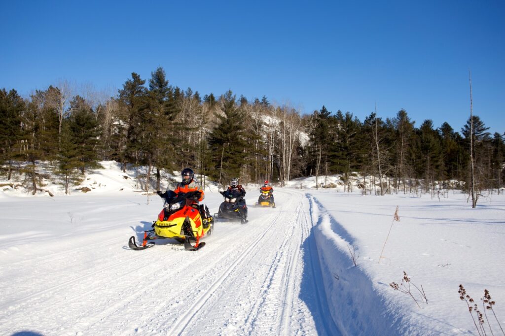
Photo © Martin Lortz for Ontario Toursim
Snowmobile RAP Tour Day One
Trailer to North Bay (drive time from Greater Toronto Area: 4 – 5 hours; Stay on Hwy 11 northbound, until you see the hotel on the east side of the road. Where We Stayed: Quality Inn North Bay Airport. Direct trail access either via SSR 711 from TOP D. (Tourism region: Northeastern Ontario)
Snowmobile RAP Tour Day Two
North Bay to Pembroke (about 8 hrs.) Ride 300 km via TOP D south/TOP A102D east/TOP A east to CT 121 (use Near North trail map to Mattawa and Snow Country Snowmobile Region map from there). Top notch riding on forest access roads and utility corridors. Fuel Stops: Stonecliffe, Pembroke. Lunch: Mattawa. Where We Stayed: Best Western Pembroke Inn. Located across road from CT off TOP A/B. (Tourism regions: Northeastern Ontario & Ontario’s Highlands)
Snowmobile RAP Tour Day Three
Pembroke to Calabogie (about 9 hrs.) Ride 300 km via TOP A south/TOP E104A west/TOP E north (maps: Snow Country Snowmobile Region). Lots of open fields and unopened road allowances for primo trail riding. Fuel Stops: Renfrew, Calabogie. Lunch: no restaurants marked on trails after Arnprior. Where We Stayed: Calabogie Motor Inn. Located across the road from TOP E and beside Murphy’s Landing restaurant and bar. Fuel is located about a kilometre east of motel on TOP E trail, past the intersection of TOP E102. (Tourism region: Ontario’s Highlands)
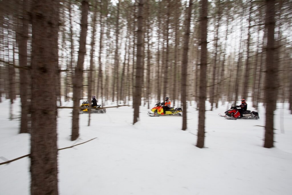
Photo © Martin Lortz for Ontario Tourism
Snowmobile RAP Tour Day Four
Calabogie to Deacon (about 9 hrs.) Ride 276 km via TOP E south & west/TOP E101 north/TOP E102 north/TOP B101A west. Use Snow Country Snowmobile Region map. Many winding and hilly forest trails and some amazing forest access roads too! Fuel & Lunch Stop: Denbigh (from trail off lake, turn right on Hwy 41 for about .5 km), Deacon. Mandatory Butter Tart stop: Pine Valley Restaurant, Griffith. Where We Stayed: Sands on Golden Lake Inn & Resort. TOP B101A goes directly through hotel property. (Tourism region: Ontario’s Highlands)
Snowmobile RAP Tour Day Five
Deacon to (south of) Madawaska (about 7 hrs.) Ride 240 km via TOP B101A north/TOP B west/TOP B106A south/TOP E109 east/CT 173 north. Use Snow Country Snowmobile Region map. Scenic forest trails plus rail trail along Madawaska River. Fuel Stops: Whitney, Madawaska. Mandatory Lunch Stop: The Mad Musher, Whitney (best burgers around!) Where We Stayed: Riverland Lodge & Black Bear Camp. Access from TOP B: lodge located on south side of Highway 60 just west of the Madawaska River bridge. (Tourism region: Ontario’s Highlands)
Snowmobile RAP Tour Day Six
Madawaska to Oxtongue Lake near Dwight (about 9 hrs.) Ride 268 km via CT 173/TOP B106E south/TOP E109 west/TOP E west/TOP B north/ CT’s 11 west, 16 north & 64 west/TOP D101B north/CT’s 65, 66 & 65/TOP D101B north/CT 74. Use Snow Country Snowmobile Region map, then Haliburton County Snowmobile Association and Muskoka. First major lake running on CT 11. Fuel Stops: Kennisis Lake, Oxtongue Lake. Lunch: The Cookhouse, Haliburton Forest Reserve, Kennisis Lake. Where We Stayed: Blue Spruce Resort. Follow stake line across Oxtongue Lake for fuel, then go back onto the lake and turn left along the same shore about ½ km to hotel. (Tourism regions: Ontario’s Highlands & Explorers Edge)
Snowmobile RAP Tour Day Seven
Dwight to North Bay (about 7 hrs.) Ride 225 km via CT 74/TOP D101B north/TOP D north/SSR 711. Note: TOP D has 13 km of road running from the intersection of TOP A101D south, so it’s best to ride this section when there’s plenty of snow on the roadsides. Fuel Stops: South River. Lunch: Antonio’s Grill, South River. Where We Stayed: Quality Inn North Bay Airport. Accessible from TOP D via SSR 711. (Tourism regions: Explorers Edge & Northeastern Ontario)
Snowmobile RAP Tour Day Eight
Trailer home
Snowmobile RAP Tour Who to Contact
Ontario Tourism, Ontario’s Highlands (south of Algonquin Park), Explorer’s Edge (west of Algonquin Park), Muskoka Tourism (west of Algonquin Park), Ottawa Valley Tourism (east of Algonguin Park), Northeastern Ontario Tourism (north of Algonquin Park). Snow Country Snowmobile Region, Near North Trails Association, Muskoka Snowmobile Region.
Snowmobile RAP Tour Maps Needed
(In order of tour use) Ontario Federation of Snowmobile Clubs Provincial Trail Guide, OFSC Near North District Trail Guide,Snow Country Snowmobile Region Trail Guide, Haliburton County Snowmobile Association Map, OFSC Muskoka District Trail Guide
Riders should reconfirm the routes and services mentioned in this Ontario snowmobile tour article as they may have changed since publication.